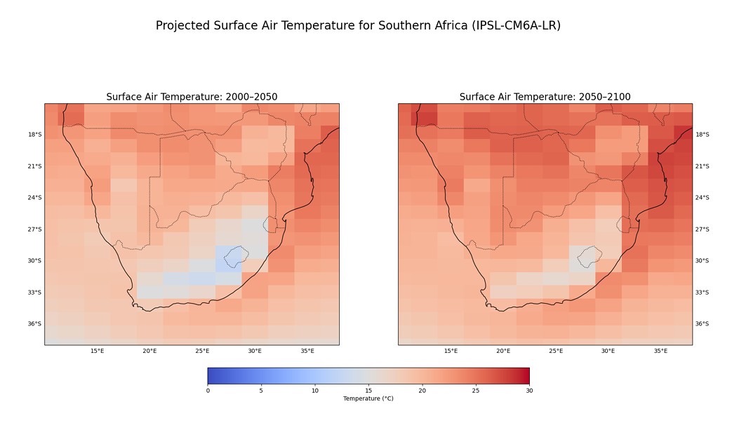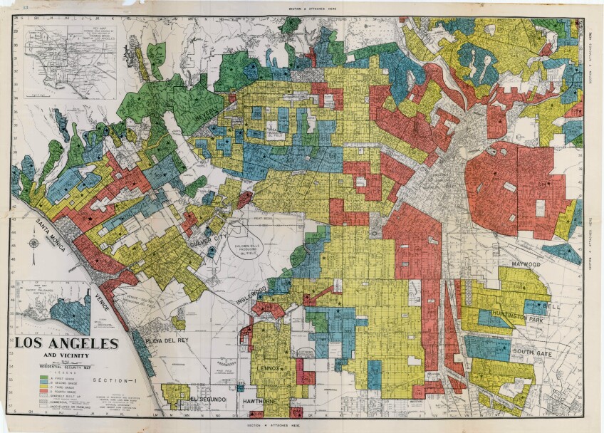
Building a data pipeline for climate projection processing
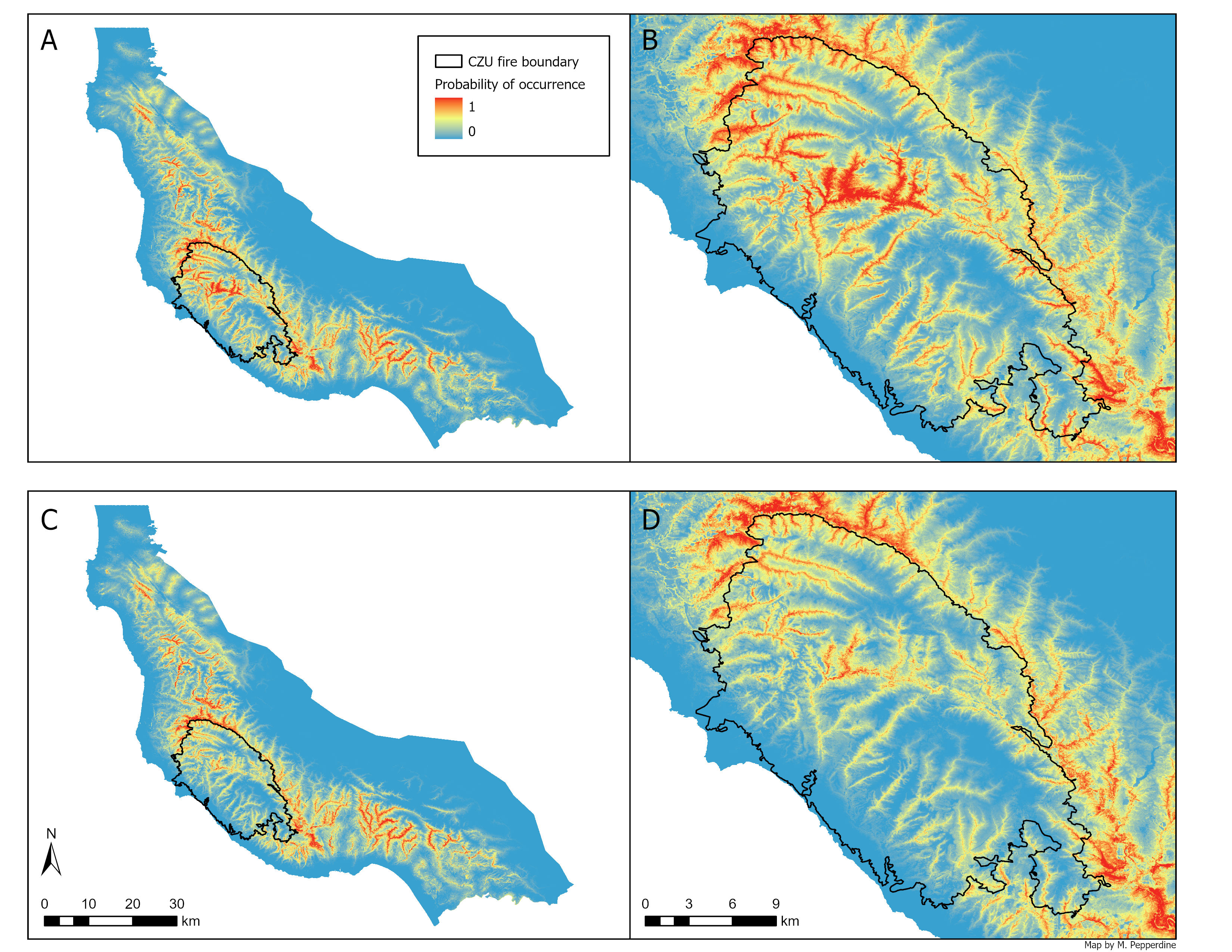
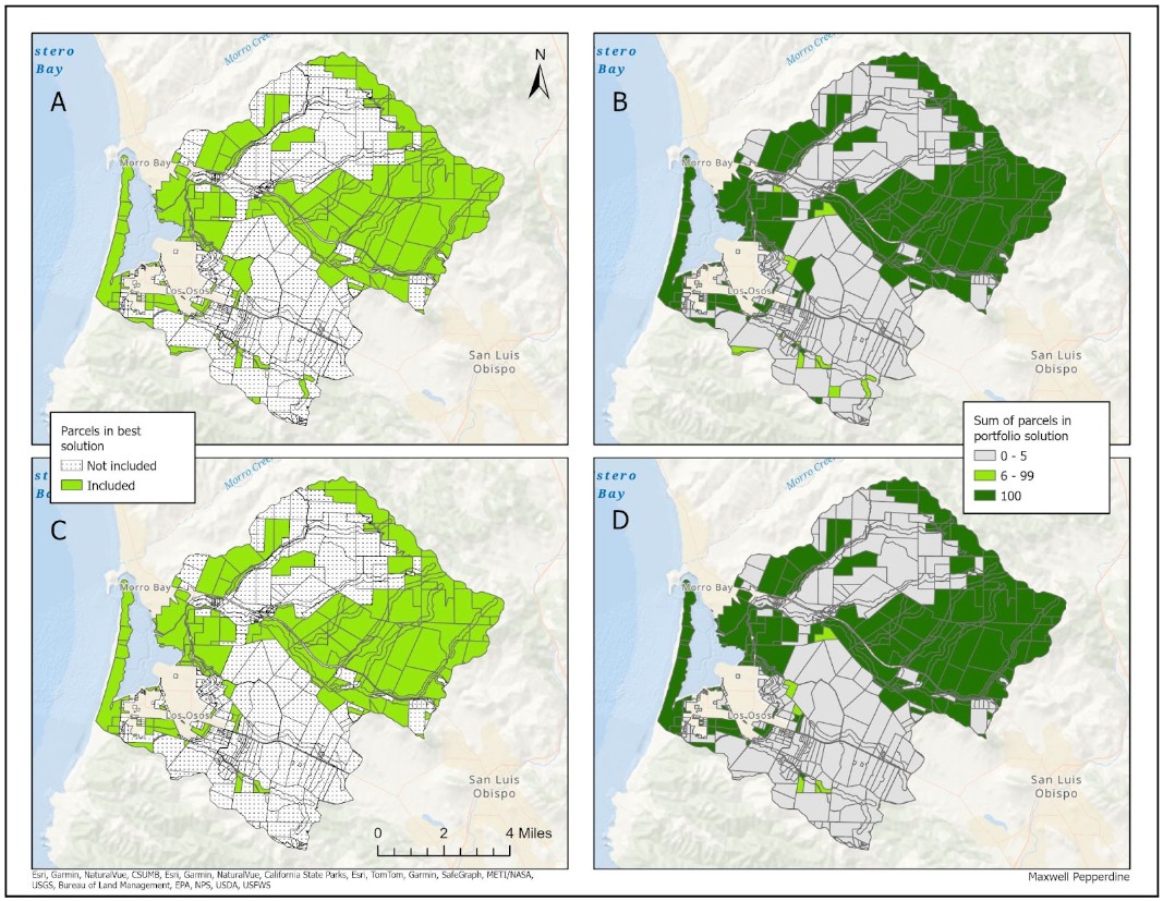
Geospatial-analysis
Conservation-planning
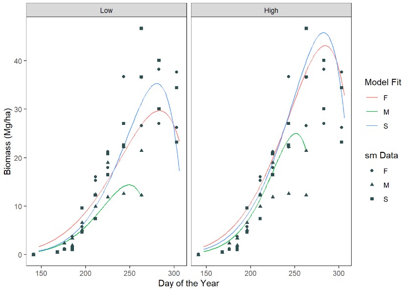
Data-analysis
RStudio
Quarto
A reproducible workflow for processing Basin Characterization Model (BCM) climate projections to support species distribution modeling under future climate scenarios
Jan 8, 2026